
Cemeteries serve as more than burial grounds. They are historical records, community landmarks, and places where families connect with generations of their heritage.
Yet behind every cemetery is a complex system of records, ownership information, burial locations, maintenance activities, and long-term planning responsibilities. As these responsibilities grow, many organizations are turning to Geographic Information Systems (GIS) to modernize cemetery management while preserving historical records for future generations.
The Challenges of Traditional Cemetery Management
At first glance, managing a cemetery may seem relatively straightforward. However, many municipal, church, association-owned, and private cemeteries face challenges that have accumulated over decades, and sometimes centuries. Burial records may exist in handwritten ledgers, spreadsheets, filing cabinets, PDF maps, or legacy databases. Ownership information may be incomplete or inconsistent. In older cemeteries, physical grave locations do not always align with historical records, creating uncertainty when families request information or staff need to identify available burial spaces.
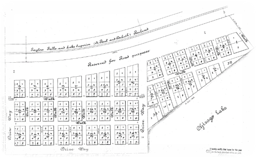
Unlike property records, which are typically managed through standardized county processes, cemetery records have often evolved independently over time. Different managers may have used different terminology, mapping methods, and record-keeping practices. Terms such as “lot,” “plot,” “grave site,” and “burial space” may have different meanings depending on the region or organization. As a result, it can become increasingly difficult to maintain accurate records and confidently answer questions about ownership, availability, or burial history.
How GIS Transforms Cemetery Operations
GIS technology offers a powerful solution to these challenges by bringing maps and records together in a single, connected system. Rather than relying on separate spreadsheets, paper maps, and databases, GIS creates a digital representation of the cemetery that links every section, block, lot, and grave space to its associated records.
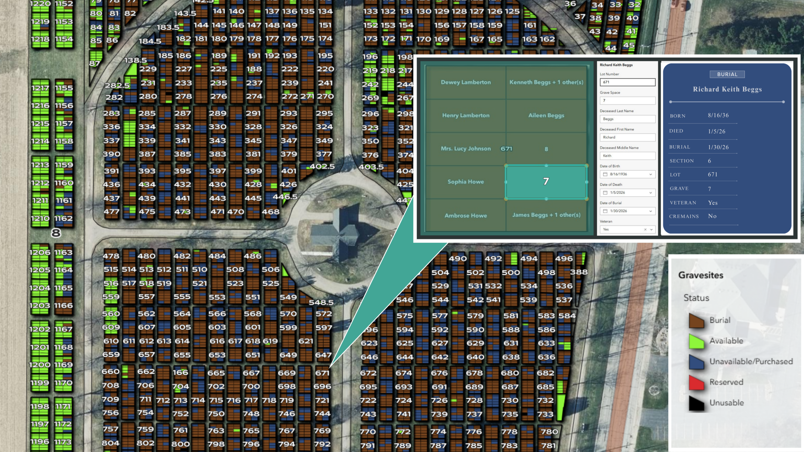
Modern GIS platforms allow cemetery managers to view and update information through an interactive map. Staff can quickly locate burial sites, search ownership records, track available plots, manage family plot divisions, and document new burials. Because records are tied directly to mapped locations, users can visualize information in ways that traditional databases cannot provide.
While burial records are essential, managing the physical landscape of a cemetery presents its own unique challenges, from identifying potential unmarked graves to planning for future expansion. By combining GIS with technologies such as drones, ground-penetrating radar (GPR), and high-resolution imagery, organizations can efficiently capture both surface and subsurface data. The result is a comprehensive, spatially enabled view that supports informed decision-making and long-term stewardship of cemetery grounds.
The benefits extend beyond internal operations. Many organizations are also using GIS to provide public-facing tools that help visitors locate gravesites, research family history, and access cemetery information online. These tools can improve customer service while reducing the time staff spend responding to routine inquiries.
Explore this interactive ArcGIS site created for the City of Clintonville, Wisconsin, cemetery.

Preserving History Through Modern Technology
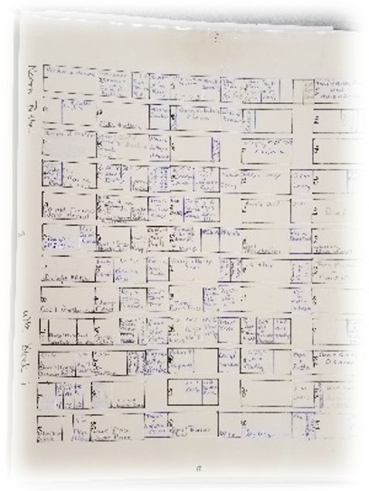
One of the greatest advantages of modern GIS solutions is their ability to preserve and integrate historical records. Cemeteries rarely have the luxury of starting with a clean slate. Information often exists in multiple formats, including CAD drawings, Microsoft Excel files, Microsoft Access databases, PDF plat maps, and handwritten records. The challenge is not simply digitizing records but ensuring that the historical information remains intact and usable.
GIS professionals can help convert and organize these legacy records into a centralized cloud-based system while maintaining the connections between burial information and physical locations. This process helps protect valuable institutional knowledge that might otherwise be lost through staff transitions, deteriorating paper records, or outdated software systems.
Building the spatial component of a cemetery database is often one of the most critical steps. Using modern GIS software such as Esri ArcGIS Pro, mapping specialists can create detailed digital representations of cemetery sections, blocks, lots, and grave sites. These maps can then be linked to burial and ownership records through unique identification systems, creating a reliable framework for ongoing management.
Once implemented, cloud-based platforms such as ArcGIS Online provide an accessible and cost-effective way to maintain cemetery data. Staff can manage information from both the office and the field, reducing reliance on paper records and improving collaboration across departments. Updates can be made in real time, ensuring records remain accurate and current.
For communities and cemetery organizations facing aging records, limited staffing resources, or increasing public information requests, GIS offers a practical path forward. The technology not only improves day-to-day operations but also helps safeguard generations of historical information. By combining accurate mapping with robust record management, cemetery operators can better serve families, improve decision-making, and preserve the stories of their communities.
For more than a decade, MSA’s GIS team has helped communities modernize cemetery record systems by converting legacy records, developing digital cemetery maps, and implementing ArcGIS-based management tools. The result is a sustainable approach to cemetery management that supports both operational needs and long-term historical preservation.
Author