


John serves as vice president and Land service line leader at MSA. He is also an active member of the company’s board of directors. As service line leader, John guides the advancement of MSA’s surveying, GIS, planning, land development, recreational development, waterfronts, landscape architecture, urban/site design, environmental, and agricultural services. He joined MSA in 2003, and throughout his career has leveraged his diverse expertise to assist public and private clients in the planning, design, and construction of infrastructure systems that expand their capabilities and enhance their quality of life. John believes in clear program development, strong stakeholder collaboration, and clear communication — tools that lead to successful outcomes and enduring projects.
Projects By John M. Langhans, PE
Great Sauk State Trail / Walking Iron Bridges & Trail
A river can define a landscape, shape a community, and inspire generations of recreation. It can also create a formidable barrier. Along the Wisconsin River in the Village of Sauk City, MSA is helping Sauk County and Dane County transform that barrier into a regional connection through the Great Sauk State Trail and Walking Iron Trail project.
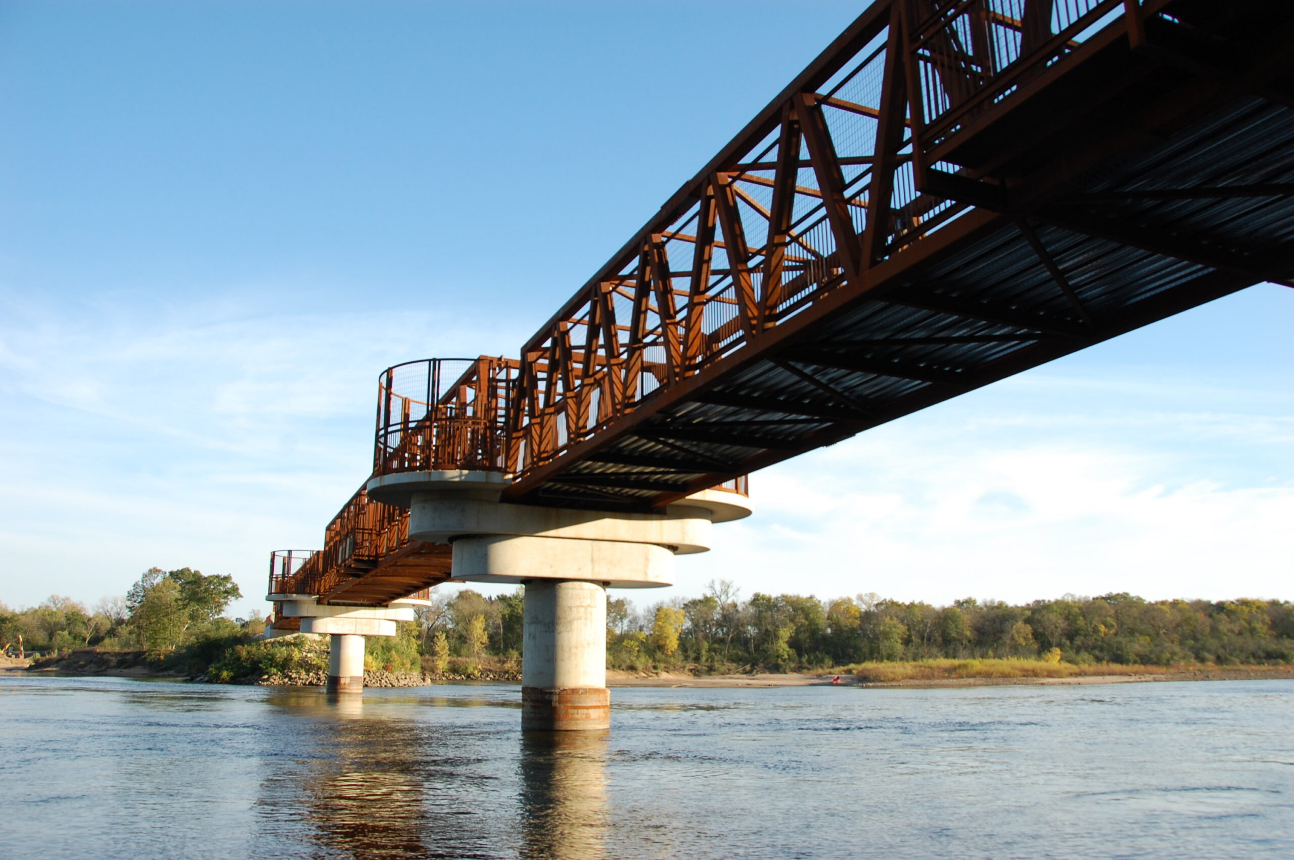
At the heart of the project is a signature bridge designed to carry bicyclists, pedestrians, and seasonal snowmobile users across the Wisconsin River. The approximately 500-foot structure connects the existing Great Sauk State Trail in Sauk County with the future Walking Iron Trail in Dane County, linking two trail systems and expanding access to destinations that will eventually include the Lower Wisconsin Riverway, Sauk Prairie Recreation Area, and Devil’s Lake State Park. The connection also advances a regional long-term vision for a continuous trail network extending west toward the 400 State Trail — and ultimately the nationally recognized Elroy-Sparta State Trail — and east, toward the broader Madison-area trail network. The crossing will also provide snowmobilers with a permanent connection to routes east of Sauk City.
Early analysis and design considerations
The project began well before engineering plans were placed on paper. From 2018 to 2019, the MSA team (MSA Professional Services, Inc. and Westbrook Associated Engineers, Inc.) worked with the two counties to complete a feasibility analysis and preliminary design study. The team evaluated potential alignments, bridge geometry, environmental considerations, and structural concepts to determine how a new crossing could meet the region’s transportation and recreational needs while respecting the sensitive riverfront setting. The project required extensive historical, cultural, and archaeological coordination associated with the former railroad corridor and historic bridge structures, requiring close collaboration with regulatory agencies to balance preservation objectives with modern recreational needs.
Early project investigation also encompassed topographic and bathymetric surveys, hydraulic and scour analyses, preliminary cost estimates, and design considerations for both multimodal and snowmobile use. The preliminary design study examined applicable rail standards and incorporated fishing and viewing opportunities, supported by high-quality renderings that allowed community members and stakeholders to envision the proposed bridge within its surroundings.

Bringing a community vision to life
The MSA team worked closely with Sauk and Dane Counties to support stakeholder coordination, public engagement, and community presentations that gathered feedback and built understanding and support for this regional vison. Trail design specialists and landscape architects developed an aesthetic framework for the bridge and designed a signature gateway feature that would give the crossing a distinct identity. Conceptual renderings helped translate technical ideas into accessible visuals, enabling residents, public officials, and project partners to participate meaningfully in the design conversation.
With a preferred concept established, the project advanced into design. The new bridge consists of three approximately 165-foot spans with pile-supported abutments at each end and two intermediate piers supported by drilled shafts with concrete caps in the river. The project incorporated ADA-compliant design and meets or exceeds all applicable WisDOT and federal Rails-to-Trails requirements. While designing the recreational crossing the bridge was engineered to be adapted to future freight rail crossing, preserving a unique long-term transportation option that allows future flexibility of converting the bridge crossing back to rail service if the need exists.

Regional connection and restoration
While the Wisconsin River bridge is the stunning new centerpiece, this project encompasses even more — weaving together a series of trail improvements into a broader regional trail experience. Visitors can now enjoy Sauk County’s newly constructed trailhead and pocket park area along Water Street in Sauk City to recharge before continuing on their journey. From the trailhead, users can now easily connect to Dane County’s newly rehabilitated historic railroad trestle — a component of the broader regional trail connection to the Walking Iron Trail set to open in 2027. The aging 533-foot trestle bridge has been rehabilitated to now support multi-modal recreational use, connecting to the Wisconsin River bridge via a new trail constructed along a former railroad grade crossing the river. Together, these improvements blend a new structure with repurposed former railroad infrastructure to create a safer, more accessible route for current and future trail users.
Regulatory compliance and project funding
Improving infrastructure within a river corridor required the project team to address needs extending far beyond the visible bridge. MSA coordinated with multiple regulatory agencies such as the Army Corps of Engineers, Wisconsin DOT, Sauk County, Dane County, and Wisconsin DNR to plan construction around environmental restrictions and infrastructure improvements. The project required careful planning to move equipment and materials to and from the site through wetlands, across river channels, and from both ends of the riverbanks. The team also accounted for future maintenance, recreational fishing opportunities, and specialized safety features to balance patron safety and maintenance considerations with enjoyable recreational experiences.
Securing funding for the project was a pivotal step in transforming the project vision into reality. MSA partnered with Sauk County, Dane County, and the Village of Sauk City in identifying, pursuing, and securing more than $5.6 million through the Transportation Alternatives Program for the bridge project. MSA provided grant writing and administration in addition to permitting coordination, construction documents, bid administration, and construction oversight. This partnership demonstrates the value of an integrated team capable of supporting a project from its earliest concept through successful implementation.

Lasting regional impacts
The project’s regional impact extends far beyond a singular river crossing. It serves as a foundational cross-county connector for all seasons of multimodal use through expanded access to current and future trail systems, a new trailhead and parking lot, five associated bridge rehabilitations, and two full bridge replacements. MSA once again teamed with Westbrook Associated Engineers, Inc. for structure design.
With Phase I of the project complete, the next phase is on the horizon. MSA helped secure an additional $1 million in Transportation Alternatives Program funding for Phase II, which includes development of approximately 2.8 miles of the Walking Iron Trail and rehabilitation of seven former railroad bridge structures on the Dane County side of the river.
More than a standalone structure, the Great Sauk State and Walking Iron Trails project represents a lasting investment in regional mobility, recreation, and connection. By linking communities and counties across the Wisconsin River, preserving historic railroad infrastructure, and creating a critical connection with an expanding regional trail network, the project helps advance a vision that extends from western Wisconsin to the Madison region. Its success demonstrates the power of thoughtful planning, environmental stewardship, and multi-jurisdictional collaboration to transform aging infrastructure into a true destination and regional asset.
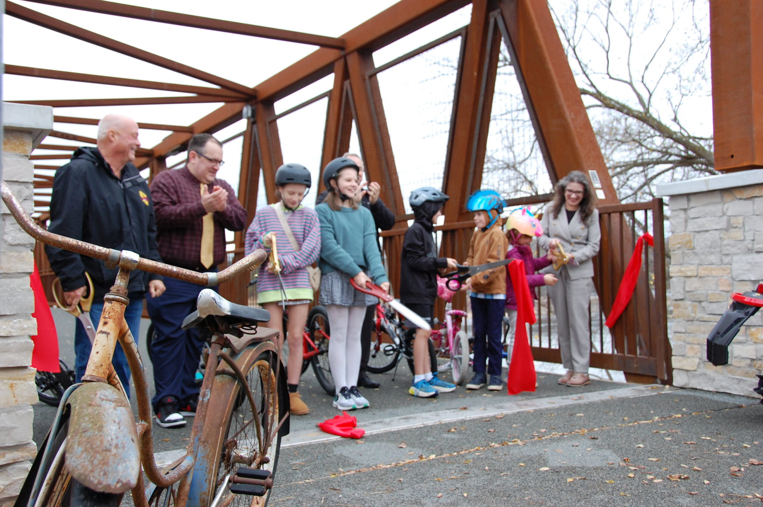
Sauk County, Dane County, the Village of Sauk City, project partners, and community members celebrated the completion of Phase I of this milestone project with a ribbon-cutting and ceremonial first crossing of the Wisconsin River Bridge on November 5, 2026.
Contact us to get the conversation started. And learn more about how MSA can be a trusted partner in meeting your community or development goals. For survey requests, please click here to fill out our survey request form.