Capital Improvement GIS Planning App
Like many communities, the City of Newport faced the exhaustive challenge of prioritizing and budgeting for a variety of infrastructure needs. MSA’s Capital Improvement Planning App provides City leaders with an easy-to-use tool for tracking past and future projects — including the means to determine inflation-adjusted unit pricing for reconstruction projects, update road ratings, forecast project costs, and organize project timelines.
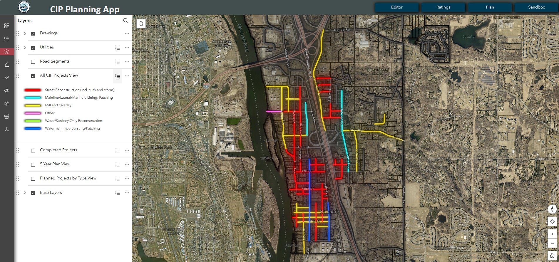
Editing and Preparing the Data
The Editor tab allows users to update road ratings, visualize past and future projects, modify road details, overlay utilities, and enter past or future projects — from utility work in unimproved rights of way to street rehabilitations or full street reconstructions. Using the data already within GIS, this approach allows the user to create a segment if any utility line or street is present, so project planning extends beyond the paved areas of the community.
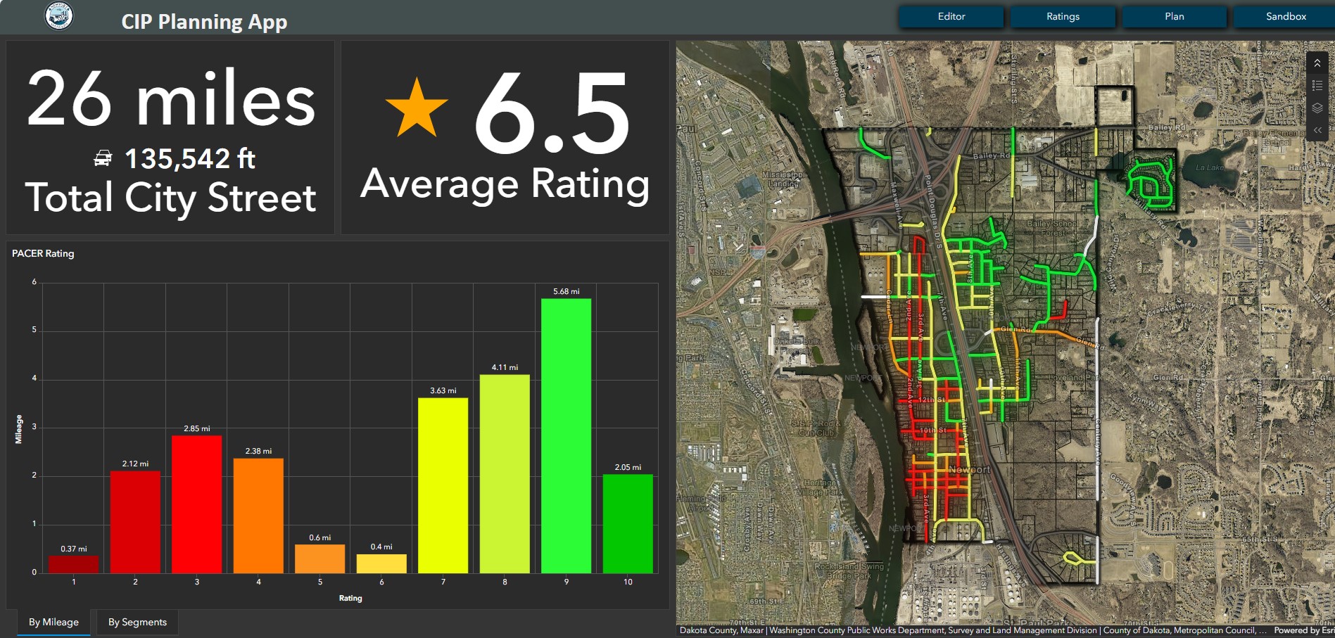
Visualizing Road Conditions
Many major capital projects are aligned with the surface condition of paved roadways. This Ratings tab provides a simple report on average citywide road condition (1-10) and other street KPIs, as well as an interactive map to visualize current road condition ratings on a simple red-green color ramp. These ratings can be updated at any time with a custom pavement inspection process done either via mobile device or in the office.
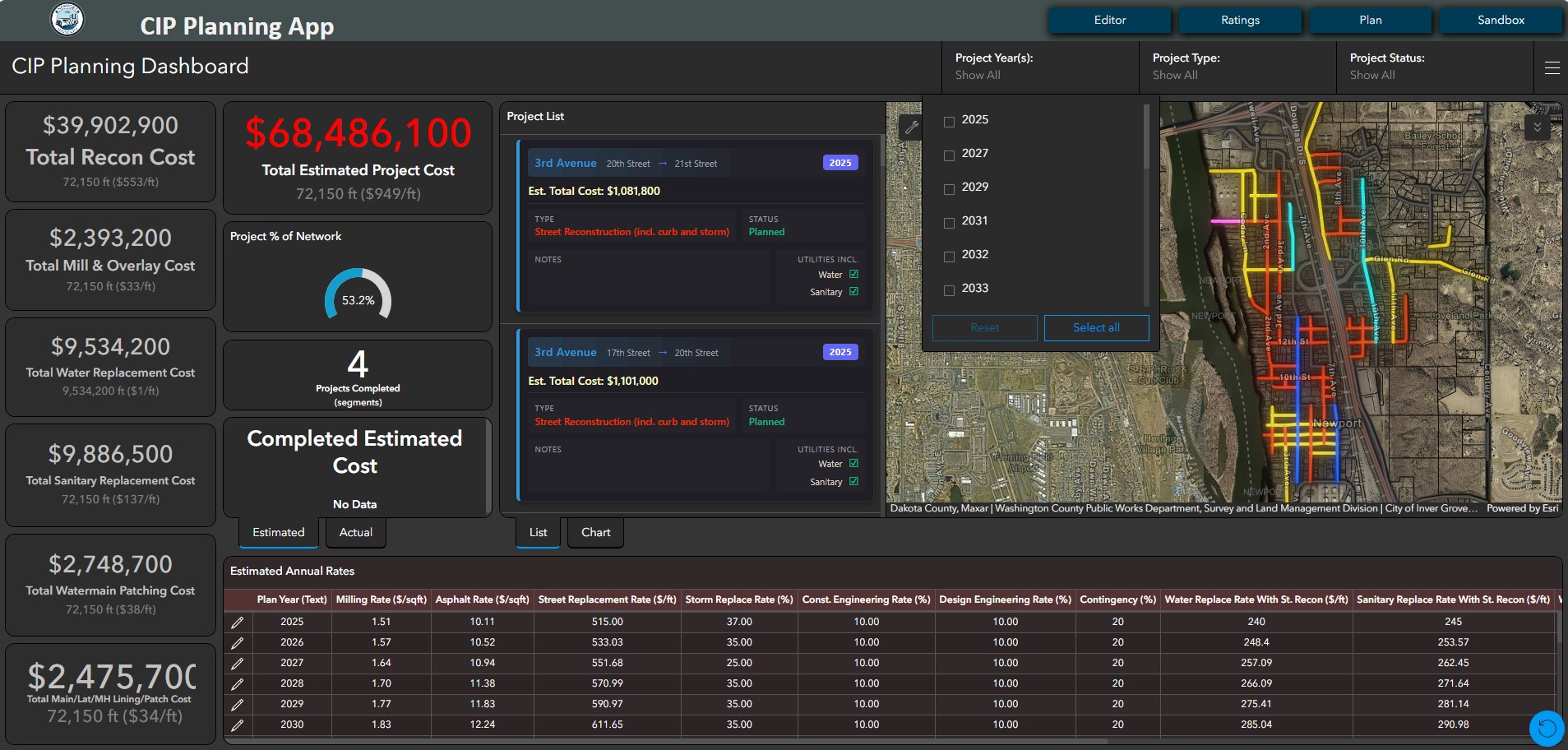
Dynamic Interactive CIP Planning Report
The Plan tab is where it all comes together. As projects get built in the Editor tab, they dynamically build the CIP plan, organizing projects into years, project type, planning status, or any combination desired by the end user. Users can verify and modify unit pricing for anything from pavement rehabilitations to street constructions or utility replacements right on this page, which tightens estimates as projects become near-term. All cost estimates and widgets are elastic to any timeframe, making this either a 50-year or a 2-year CIP with just a few clicks.
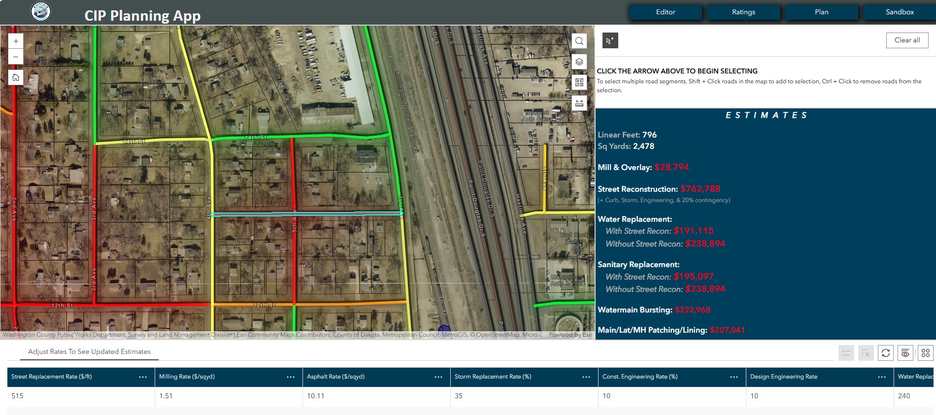
Sandbox Mode
The Sandbox tab provides real-time estimates of any given project type for any given road or segment of utilities. Simply verify unit rates, select segment(s), and the sandbox delivers the estimated costs for doing any given project type. This is a great feature for exploring projects to fit within annual budget targets. Within the sandbox, staff can easily overlay utility conditions and pavement conditions to cost-effectively allocate limited resources to address the areas in most critical need of rehabilitation.
In Summary
MSA’s Capital Improvement Planning App is an excellent one-click companion for communities looking to organize their capital improvement plan and process. The app is easily modified to handle a variety of customizations and scenarios — and has been developed to easily scale down to serve as purely a pavement management solution with all these same capabilities.
Contact Project Lead

Jeff Powell, sUAS
GIS Team Leader